
For transport and logistics
The route that fits your truck or coach
Truckroute plans a truck route by number plate with every restriction that comes with it: low-emission and zero-emission zones, traffic signs for height, weight, length and width, closures, the Dutch truck charge and tolls, LHVs, abnormal loads and ADR tunnels. One route planner, official sources only.
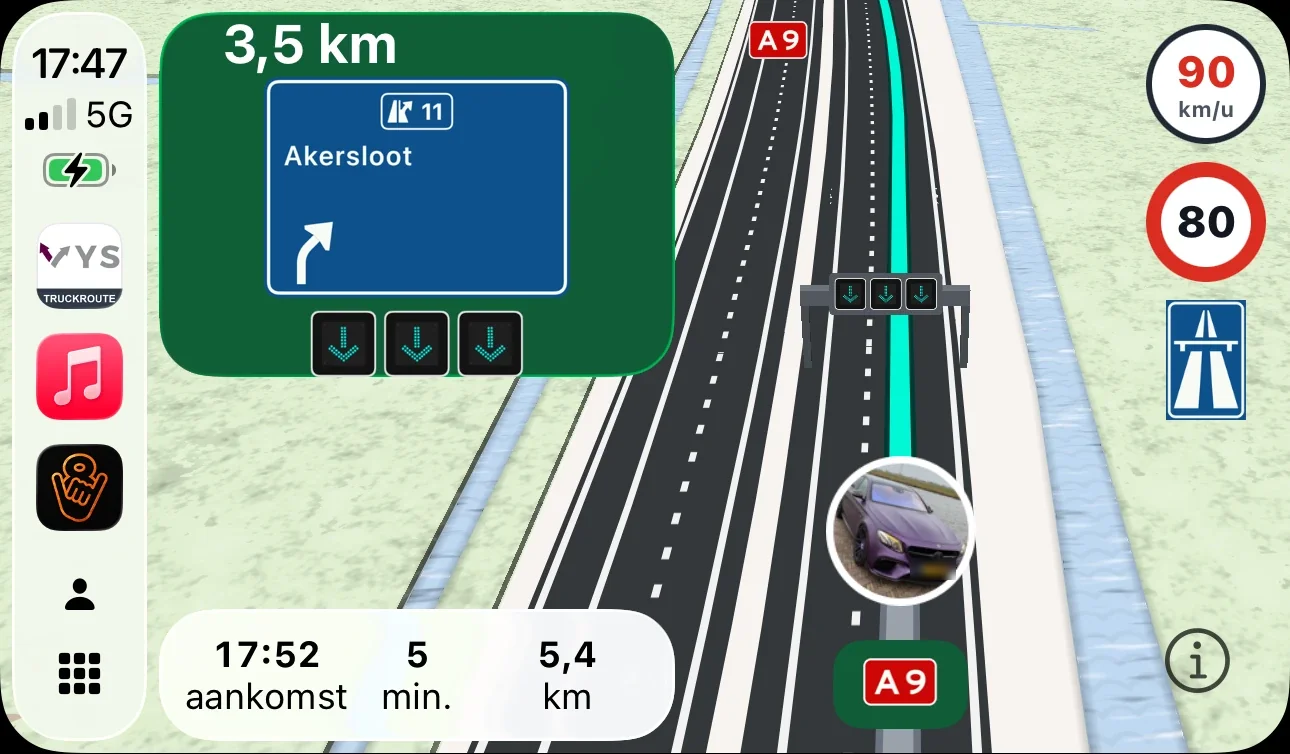
Also as an app for iPhone and Android, with navigation and Apple CarPlay: see the app
App and CarPlay
The Truckroute app for iPhone, Android and Apple CarPlay
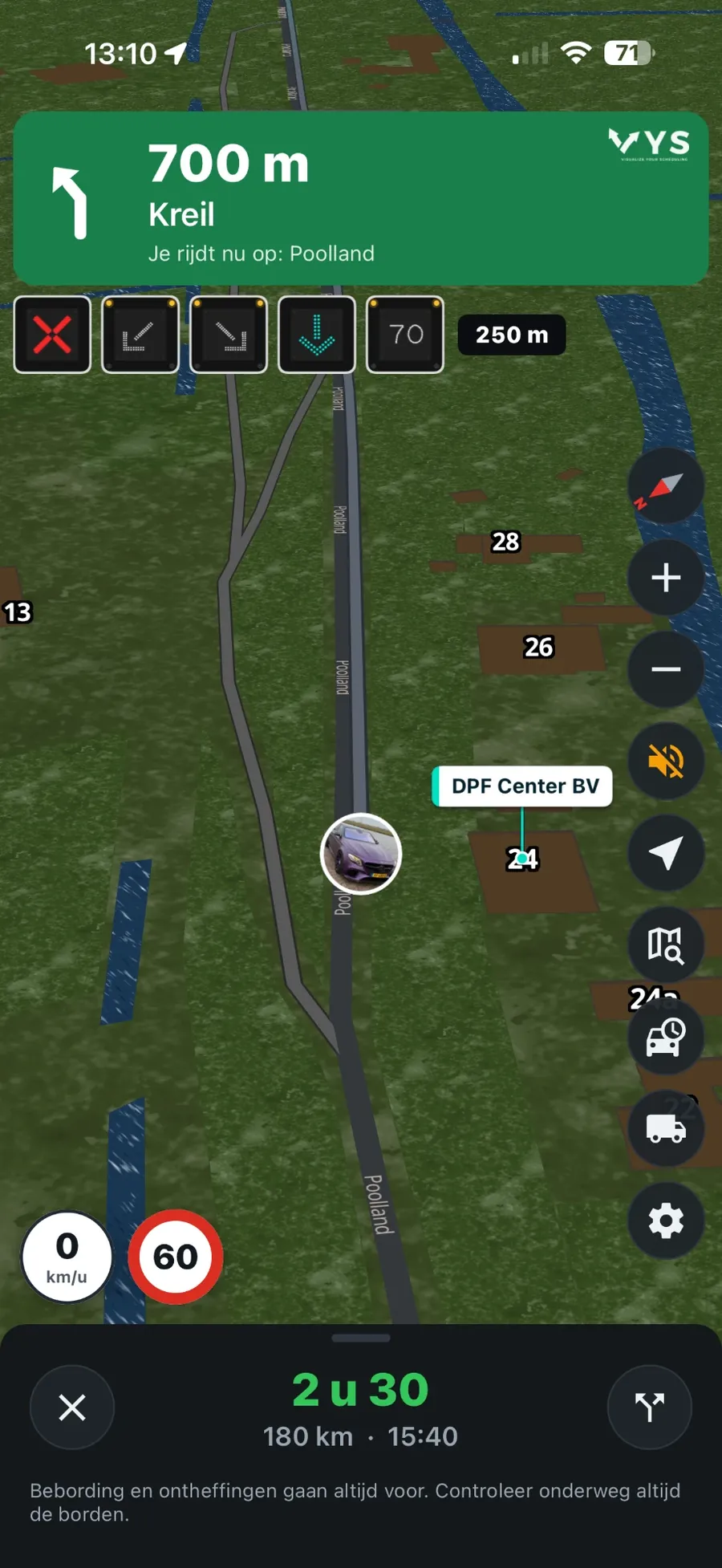
The route Truckroute plans by number plate, you navigate with the app on your iPhone or Android phone and in CarPlay. The same account as on the website.
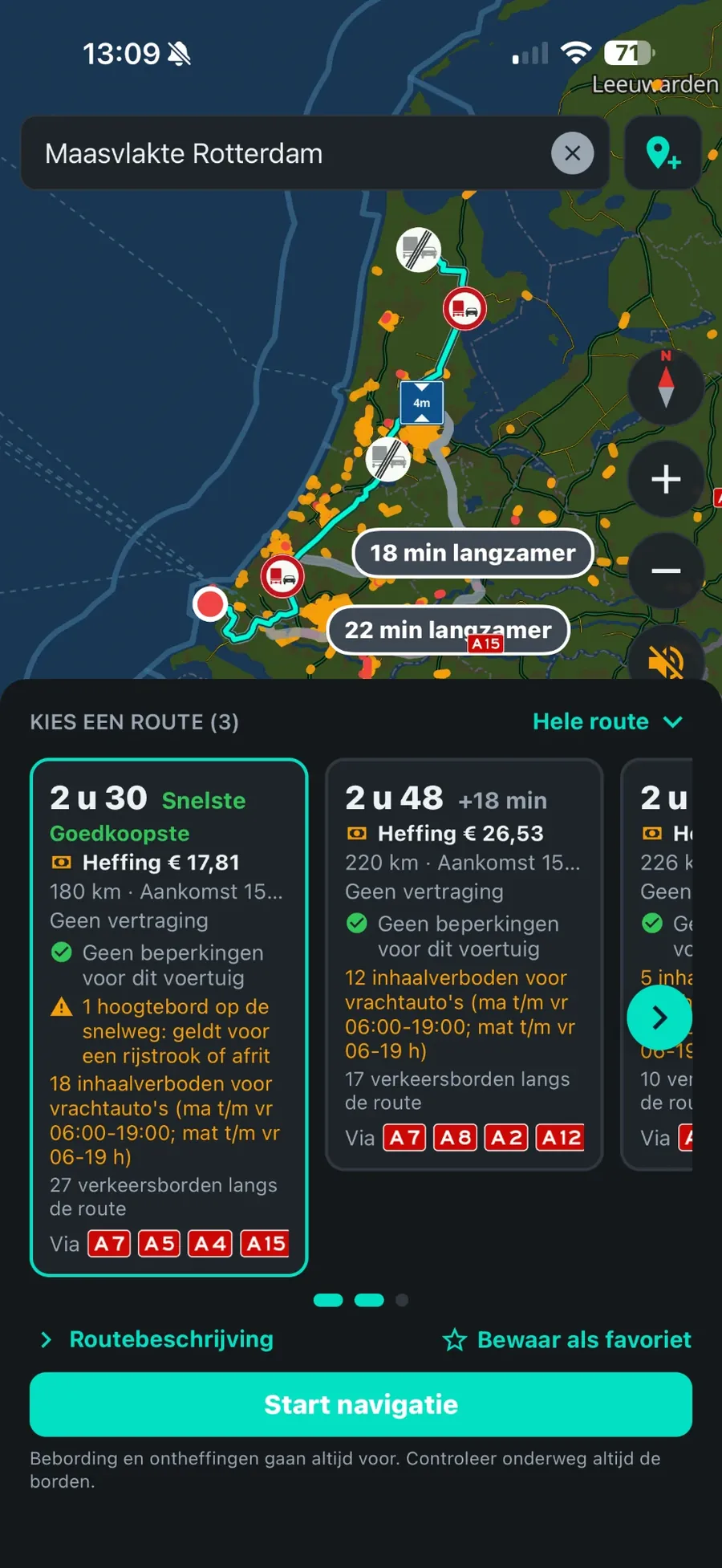
- Navigate the route that fits your truck, with the lanes at every exit and voice guidance.
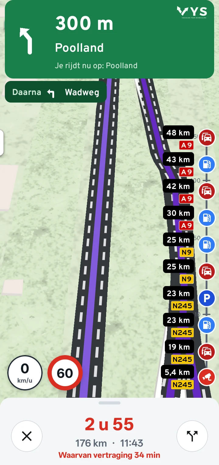
- Live on the road: traffic jams, overhead signs per lane, roadworks and closures during your trip.
- Timeline: truck parks with free spaces, fuel stations and speed cameras on the coming kilometres.
- Apple CarPlay: the map, the route and the next turn on the screen in the cab.
Everything that shapes a truck trip, in one route planner
Which zone may this tractor enter, and until when? Does it fit under that bridge? Does a detour around the charge pay off? May this LHV or abnormal load drive here, and which tunnel may this load pass? Whoever looks that up per trip in separate sources loses time; whoever misses it risks a fine or a trip that does not go ahead. Truckroute checks it all at once, for the vehicle behind the number plate.
Everything in one route planner
- Route by number plateWeight, dimensions, Euro class and CO2 class from the RDW: the route fits the vehicle.
- Low-emission zonesPer number plate where you may enter and until when, in the Netherlands and Europe.
- A route that fitsHeight, width, length, weight, axle load, signs and closures.
- Dutch truck chargePer trip with the rate of your number plate, and smart avoidance when it pays off.
- Tolls in EuropeMaut, Belgian distance charge and Eurovignette per trip.
- LHVOnly on the RDW LHV network.
- Abnormal loadsFetch or read in your exemption (NL, BE, DE) and navigate without ever deviating.
- ADR tunnelsAround every tunnel prohibited for the tunnel code of your load.
What Truckroute does for you
Per number plate: which zones, until when
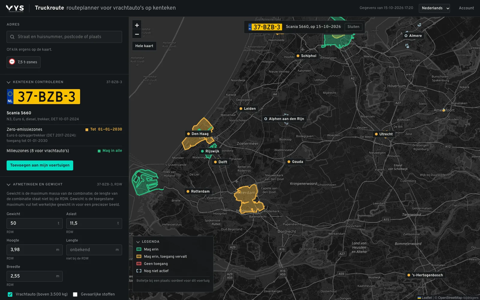
Enter a number plate and Truckroute fetches the vehicle from the RDW. Every low-emission and zero-emission zone gets a verdict: may enter, may enter until a date, or no access. A Euro 6 tractor unit from 2024 may still enter the zero-emission zones until 01-01-2030 (status 12-10-2026). The route avoids the zones your vehicle may not enter.
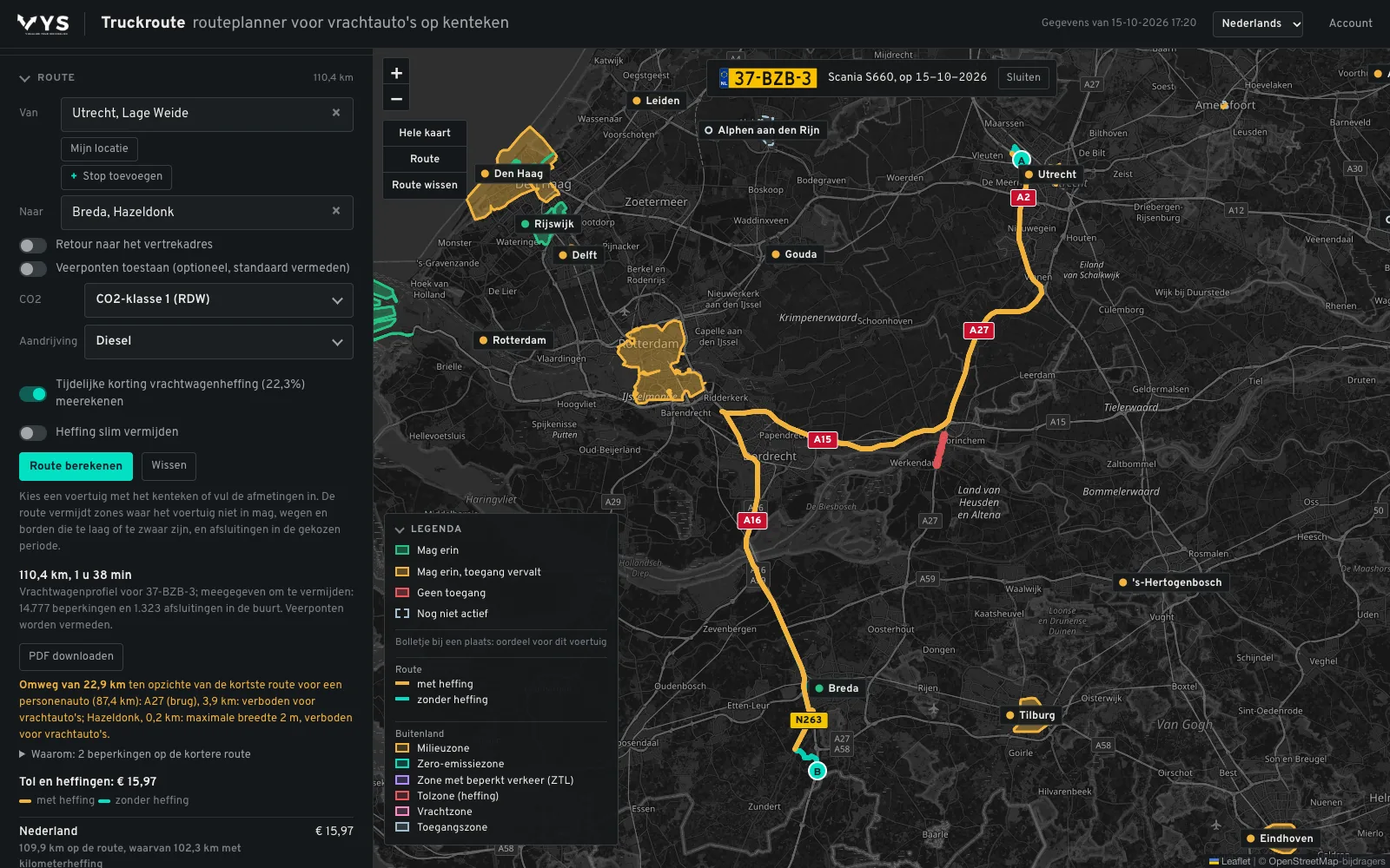
Utrecht to Breda: a route that fits
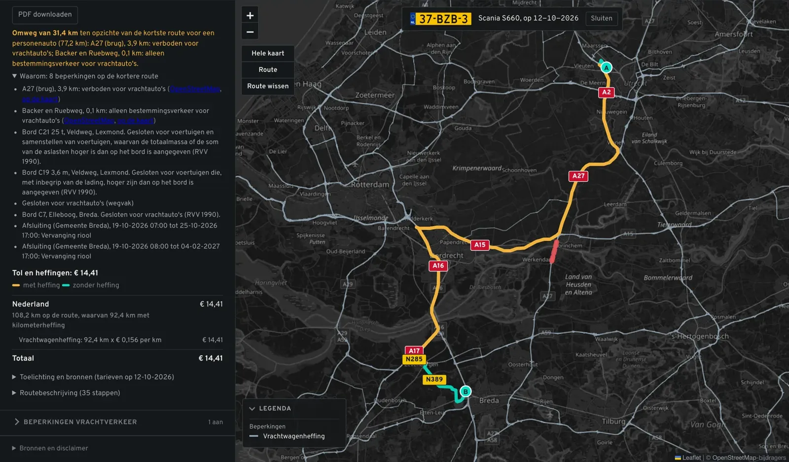
A car takes the A27. A truck does not: the Merwede bridge is closed to trucks. Truckroute avoids every restriction, here 31.4 km longer via the A15 and the A16, and explains why with the route: every traffic sign, every weight and height restriction and the closures (calculated on 12-10-2026). Driving empty or more heavily loaded this time? When planning, you simply change the gross combination weight for this route only.
Charges per trip, and when a detour pays off
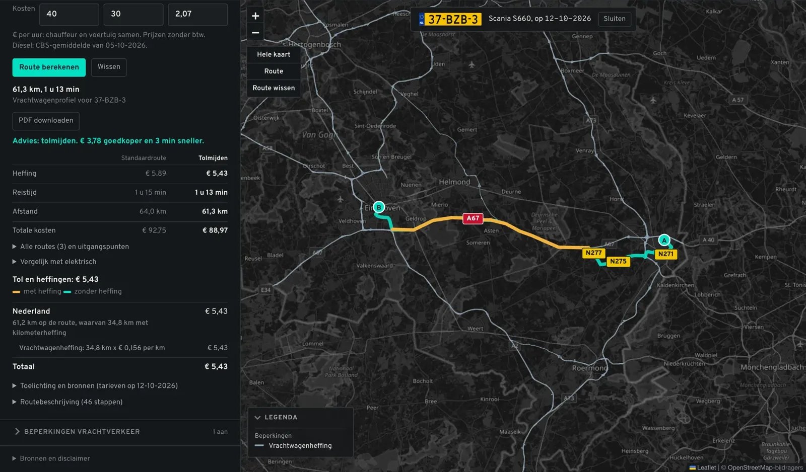
Truckroute calculates the Dutch truck charge per road section with the rate of your number plate, and compares the motorway with a route with fewer charges: charge, driving time and diesel together. From Venlo to Eindhoven the route with less motorway is € 3.78 cheaper and 3 minutes faster; from Moerdijk to Tilburg it does not pay off, and Truckroute says so too (calculated on 12-10-2026). Plus the German Maut, the Belgian distance charge and the Eurovignette.
LHV: only on the LHV network
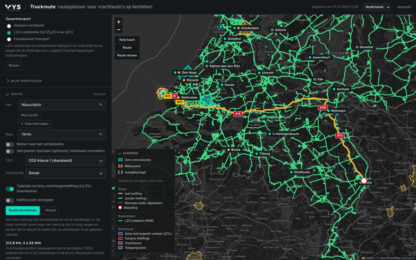
Choose LHV under Dimensions and weight and Truckroute plans only on the RDW LHV network, with at least 25.25 m and 60,000 kg. From the Maasvlakte to Venlo: 212.8 km on the green network (calculated on 15-10-2026). More about LHVs
Abnormal loads: within the RDW decision space
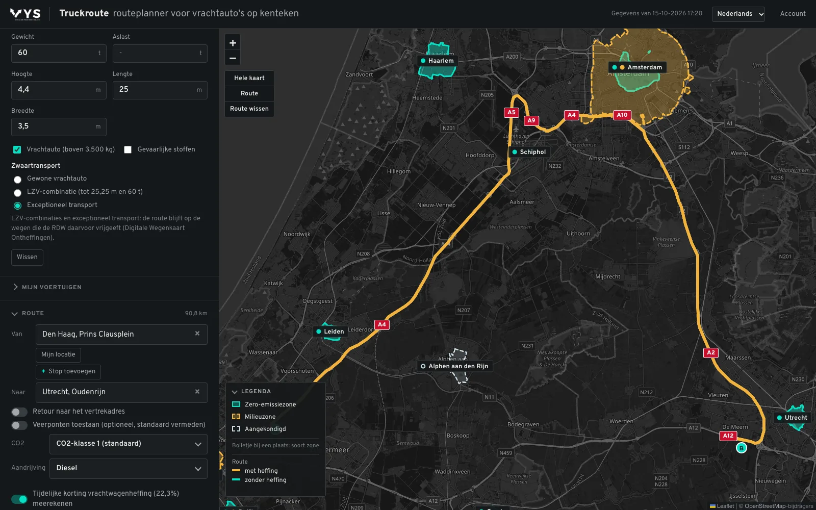
Choose abnormal load and enter the dimensions of the transport. The route only uses roads where the RDW itself can grant an exemption for that height, width, length and weight. At 4.4 m high, 3.5 m wide, 25 m long and 60 tonnes, the trip from the Prins Clausplein to Oudenrijn does not use the A12 but the A4, the A10 and the A2: 90.8 km (calculated on 15-10-2026). Both networks come from the RDW Digital Exemptions Road Map and are refreshed every week; the exemption itself remains required and binding.
Already have an exemption? Truckroute is the only navigation app that lets you navigate with just your RDW/DWO permit number. The route follows the exemption 100% and the navigation never deviates from it. Every structure on the route is shown: Truckroute knows all of the more than 15,000 bridges, viaducts, tunnels and level crossings in the Netherlands. A Belgian or German permit you read in as a PDF too, and a trip across the border becomes one continuous route. All about abnormal loads
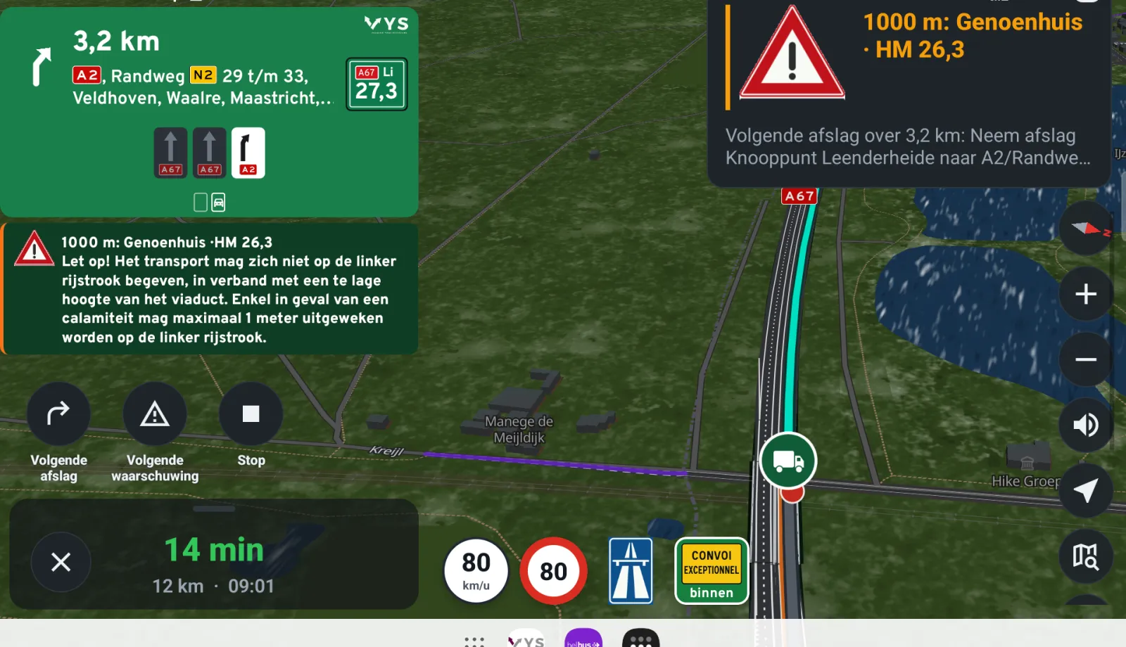
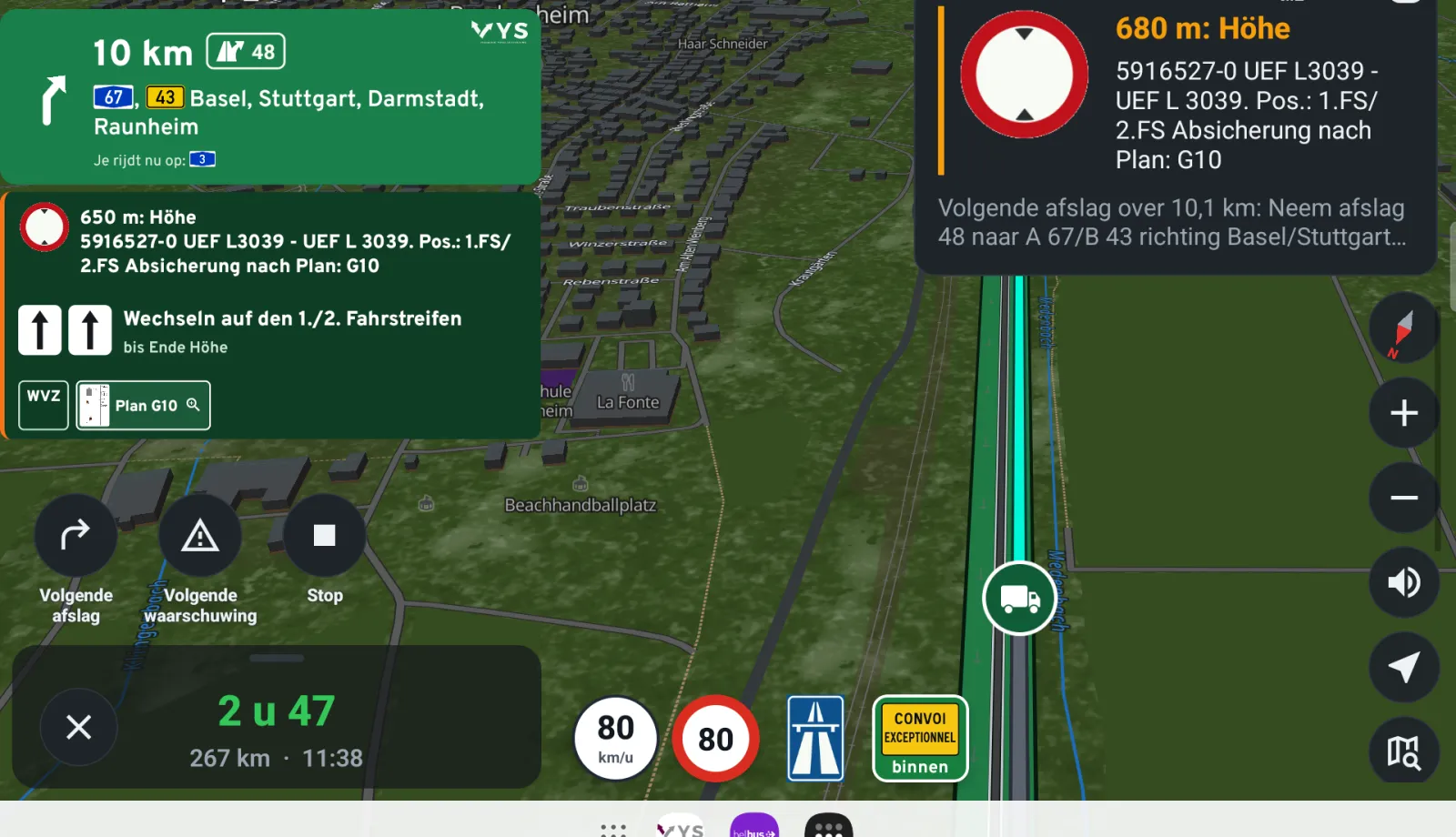
Navigating along your permit, in the Netherlands and Germany
On the way, Truckroute tells you what your exemption or permit requires, at the moment it matters.
Dangerous goods: the right tunnels
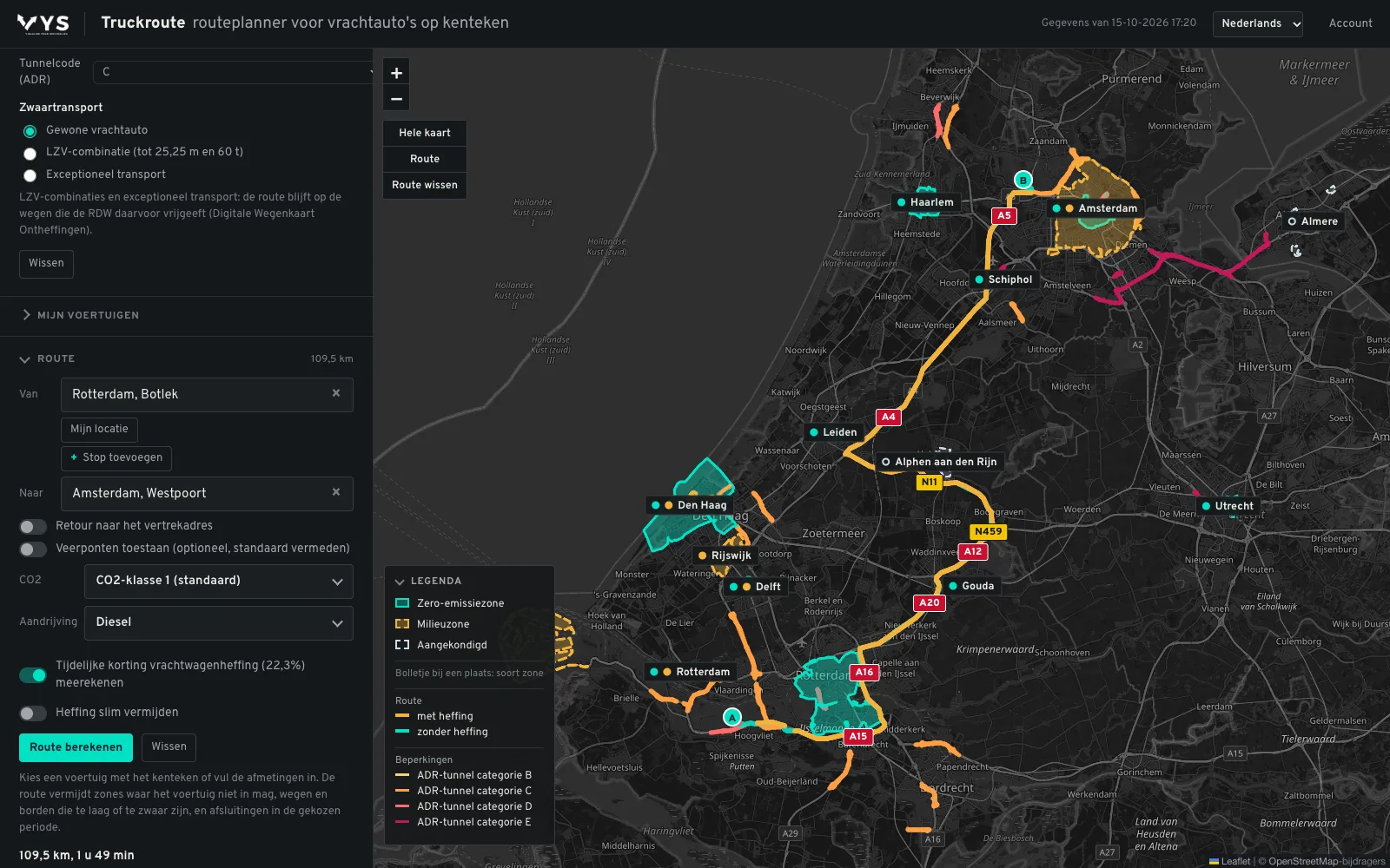
Choose the ADR tunnel code of your load, B to E, and Truckroute avoids every tunnel that is prohibited for that code, in the Netherlands, Belgium, Luxembourg and Germany. The ADR tunnels layer shows all tunnels with their category on the map. From the Botlek to the Western Port Area of Amsterdam with tunnel code C: 109.5 km, around the prohibited tunnels (calculated on 15-10-2026). For the Netherlands and Spain, Truckroute also follows the mandatory designated routes for dangerous goods: in the Netherlands the routes for route-bound substances (routeplichtige stoffen) where they are known, and in Spain the RIMP, the road network for dangerous goods. More about ADR tunnels
Fixed routes: the driver drives exactly your route
Not point to point, but the complete route exactly as you set it up. Draw the route in Route management, down to the street: drag points, add them or draw by hand, and put it live. In the app the driver first sees a summary and the route description, then drives exactly along your line, from the distribution centre or from where he is. If he leaves the route, the app takes him back along a safe way to a point ahead of him on the line. Every route can have a start and end date and is protected by a PIN.
Night bans and time windows: a warning, not a detour
Many truck bans only apply at certain hours, such as the night bans in Swedish towns from 22:00 to 06:00. Truckroute knows those times. If your passage falls within the window, the app warns you; outside it the route simply drives through, without a needless detour. In Sweden more than 80,000 signs with a time window or an exception are on the map, straight from the national road database, alongside the permanent bans, heights, weights and axle loads.
On the road as well
Truckroute works on the driver's phone, with My location as the starting point. Plan a trip with up to 23 stops, with a round trip, and navigate it with the Truckroute app, also in CarPlay. The route planner is available in 23 languages.
Who it is for
- Planners see at once which trip works with which vehicle, also for tomorrow or next year.
- Drivers know why a route takes a detour, and navigate it in the app.
- Quotations and post-calculation get charges and tolls per trip in advance.
- Heavy transport sees in advance which roads an LHV or an abnormal load can use.
- Fleet management sees which vehicles may no longer enter a zone, and when.
- Road workers and road inspectors navigate in the app to a hectometre post, on the left or right side of the road.
- Agriculture and contracting navigate the tractor in the app over the agricultural road map, never on the expressway and around sign C8: navigation for agricultural vehicles.
- Construction, earthmoving and delivery navigate in the app to a cadastral parcel in the Netherlands, also where there is no address.
Pricing
Truckroute comes in tiers, from one user to large transport companies with their own rate. Every tier includes all functions; you pay by the number of users. The amounts follow soon. All prices exclude VAT.
One user
Owner-driver or planner
1 user
Price to follow
- All route planner functions
- Zones, restrictions, charges and tolls
- LHV, abnormal loads and ADR
Small company
A few planners and drivers
2 to 5 users
Price to follow
- All route planner functions
- Zones, restrictions, charges and tolls
- LHV, abnormal loads and ADR
Transport company
Planning and fleet
6 to 25 users
Price to follow
- All route planner functions
- Zones, restrictions, charges and tolls
- LHV, abnormal loads and ADR
Large transport company
Several sites or a large fleet
More than 25 users
Custom rate
- All route planner functions
- Zones, restrictions, charges and tolls
- LHV, abnormal loads and ADR
New? Create an account with your e-mail address and try the route planner free for 7 days. A rate for your company? E-mail info@truckroute.nl or call +31(0)85-4013599.
Frequently asked questions
What does Truckroute cost?
Prices come in tiers: from one user to large transport companies with their own rate. Until they are published, ask VYS Scheduling BV for a rate.
Can I try Truckroute first?
New? Create an account with your e-mail address and try the route planner free for 7 days.
Do I need a password?
No. You log in with your e-mail address and a code you receive by e-mail.
How does it differ from Zonetoegang and Tolmijden?
Zonetoegang tells you by number plate which zones you may enter and until when. Tolmijden plans routes to avoid the Dutch truck charge. Truckroute is everything together: route planning by number plate with zones, restrictions, charges and tolls, heavy transport and ADR.
Does it work on a phone?
Yes, in the browser of your phone, with My location as the starting point.
Where does the data come from?
Only from official sources: the RDW (vehicles and the Digital Exemptions Road Map), Rijkswaterstaat, the Dutch government, municipalities and the governments of other countries, the Dutch Truck Charge Act and the Government Gazette, Statistics Netherlands for the diesel price, and OpenStreetMap for the roads and the ADR tunnel categories.
Try it on your own trips
New? Create an account with your e-mail address and try the route planner free for 7 days. A demonstration or a rate for your whole fleet? Contact VYS Scheduling BV: info@truckroute.nl or +31(0)85-4013599.
All amounts exclude VAT. Truckroute results are an indication; exemptions, signs and the official maps prevail, and no rights can be derived from these pages or the route planner. Privacy
All topics
Route and restrictions
Navigation and CarPlay
Charges and tolls
LHV
Abnormal loads
- Abnormal loads: from exemption to navigation
- Navigation for abnormal loads
- Route for abnormal loads
- Exemption for abnormal loads: annual or one-off
- Legal dimensions and weights of a truck
- Route for high loads above 4 metres
- Route for wide loads
- Route for heavy loads above 50 tonnes
- Route for long loads
- Plan a route over the RDW exemption roads (DWO)
Dangerous goods and tunnels
Coach and bus
Cranes
Agriculture and parcels
- Navigation for agricultural vehicles
- Tractor navigation app: how to set it up
- Route over the agricultural road map
- May a tractor use the expressway or motorway?
- Sign C8: closed to agricultural vehicles
- How fast may a tractor go: 25 or 40 km/h
- Navigation for agricultural contractors and farms
- Navigating to a cadastral parcel
Zero-emission zones per city
- Zero-emission zone 's-Hertogenbosch: truck route and exemption
- Zero-emission zone Almere: truck route and exemption
- Zero-emission zone Alphen aan den Rijn: truck route and exemption
- Zero-emission zone Amersfoort: truck route and exemption
- Zero-emission zone Amsterdam: truck route and exemption
- Zero-emission zone Apeldoorn: truck route and exemption
- Zero-emission zone Arnhem: truck route and exemption
- Zero-emission zone Assen: truck route and exemption
- Zero-emission zone Breda: truck route and exemption
- Zero-emission zone Delft: truck route and exemption
- Zero-emission zone Den Haag: truck route and exemption
- Zero-emission zone Deventer: truck route and exemption
- Zero-emission zone Ede: truck route and exemption
- Zero-emission zone Eindhoven: truck route and exemption
- Zero-emission zone Enschede: truck route and exemption
- Zero-emission zone Gouda: truck route and exemption
- Zero-emission zone Groningen: truck route and exemption
- Zero-emission zone Haarlem: truck route and exemption
- Zero-emission zone Haarlemmermeer: truck route and exemption
- Zero-emission zone Leiden: truck route and exemption
- Zero-emission zone Maastricht: truck route and exemption
- Zero-emission zone Nijmegen: truck route and exemption
- Zero-emission zone Rotterdam: truck route and exemption
- Zero-emission zone Tilburg: truck route and exemption
- Zero-emission zone Utrecht: truck route and exemption
- Zero-emission zone Venlo: truck route and exemption
- Zero-emission zone Zwolle: truck route and exemption