
App
The Truckroute app for iPhone, Android and CarPlay
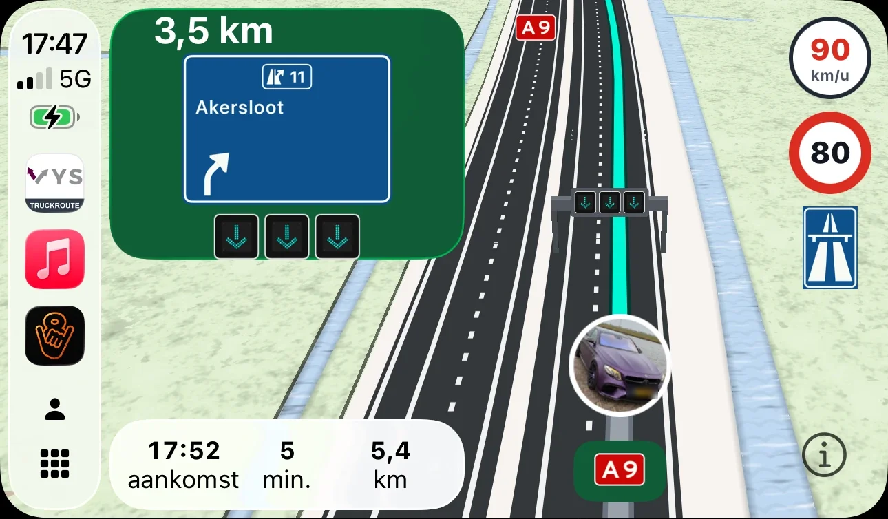
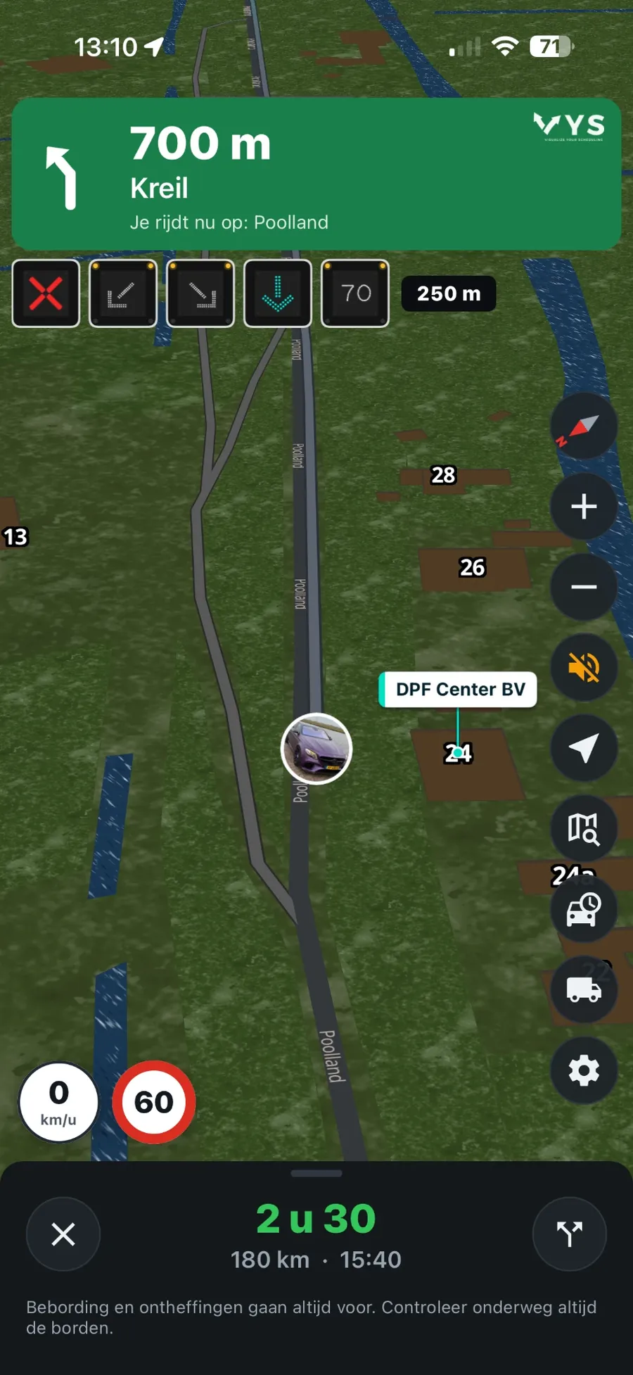
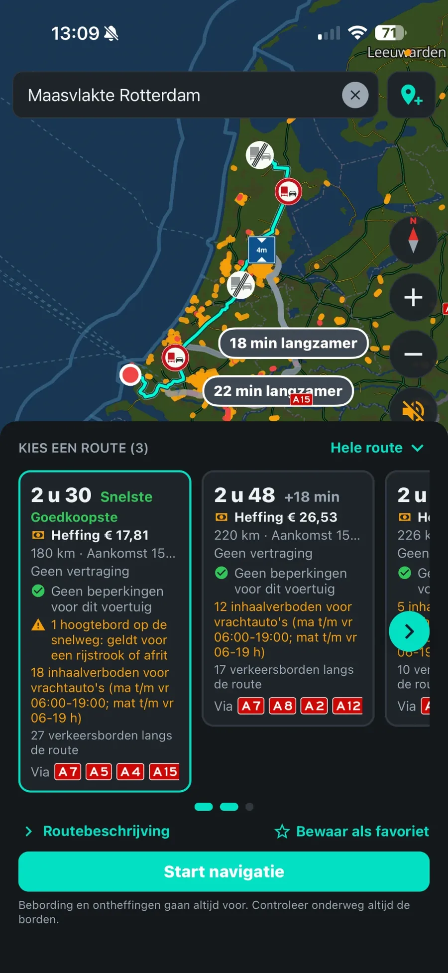
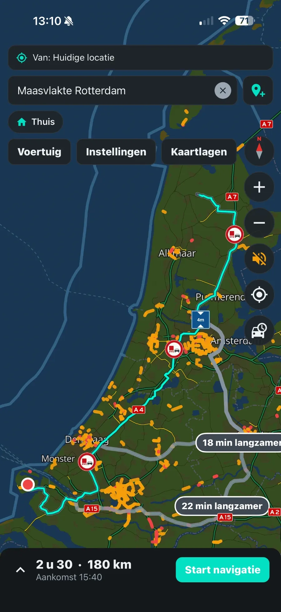
Navigation for trucks based on your number plate: the route avoids signs for height, width, weight and axle load, and on the way you see live traffic, overhead signs, lanes and overtaking bans. On your iPhone or Android phone, and on the screen in the cab with Apple CarPlay.
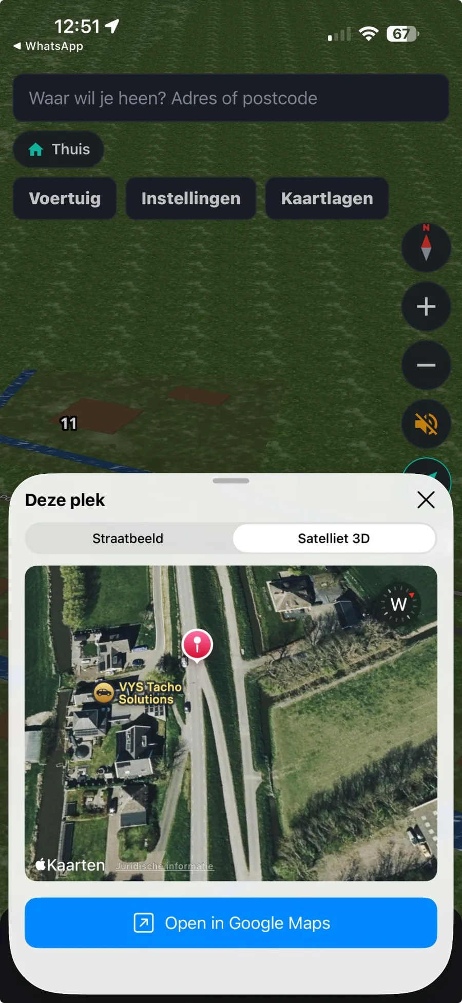
View a place: street view and 3D satellite
Press and hold on the map and you see that place straight away, without leaving the app: Street view (Apple Look Around) and 3D satellite. That way you see in advance what an entrance, loading bay or business site looks like, where the gate is and whether there is room to turn.
With one tap you open the same place in Google Maps, with Street View. Street view needs iOS 16 or later and is available where Apple has captured the street.
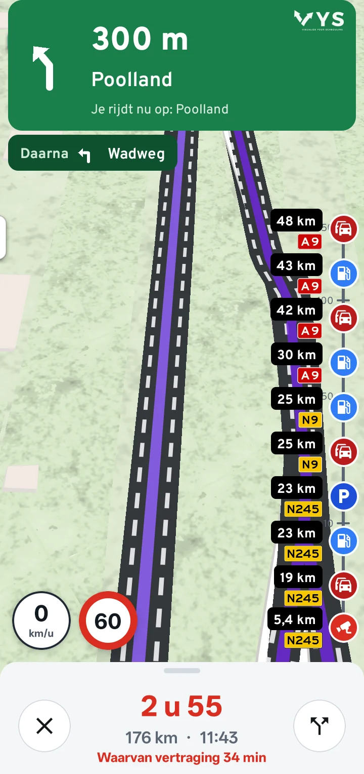
Timeline: what lies along your route for the next 150 km
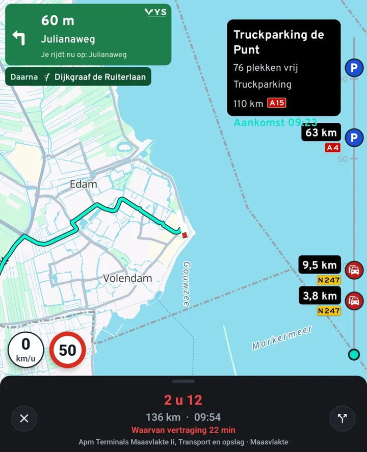
Turn on the timeline and you see on the right of the map what is coming up on your route, with the nearest at the bottom: the first motorway rest area within 150 km, fuel stations within 50 km, traffic jams, and speed cameras, average speed checks, overtaking bans, prohibition signs and weight limits within 10 km. Each item shows the distance and the road number.
Tap an item for the name, the address and when you will get there. You choose what the timeline shows. In Apple CarPlay too, the timeline is on the right of the map, with your speed and the speed limit above it.
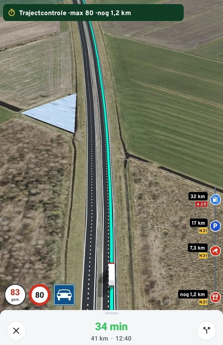
Average speed check: your average speed on screen
When you enter an average speed check, a bar at the top shows the speed limit and how many kilometres of the check are left. At the bottom left, the speed dial then shows your average speed over the stretch (avg), and it turns red when you are above the limit.
In the timeline on the right you see the end of the average speed check, the next speed camera, the rest area and the fuel station, each with the distance and the road number.
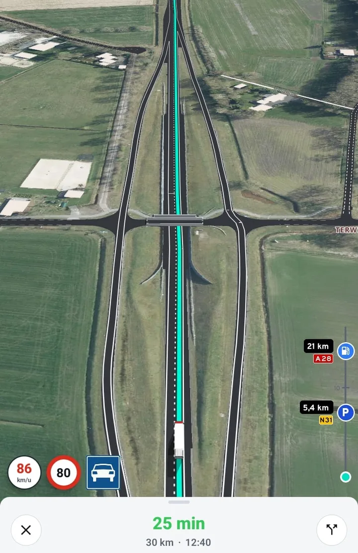
Driving over an aerial photo
Choose Aerial photo as the map theme and you navigate over a real aerial photo. On top of it the app draws the lanes and markings, the green route and your truck, so you see exactly how a junction, a flyover or a crossing is laid out.
Your speed, the speed limit and the road type are at the bottom left, the timeline on the right. You can choose the theme for Apple CarPlay too.
Truck parks: see how many spaces are free
At truck parks in the Netherlands you see, where the park reports it, how many spaces are free right now. So you know while driving whether you can park there, before you leave the motorway.
Tap a rest area in the timeline and you see the name, the free spaces, the type of parking, the distance and the road number, and when you will get there.
For road workers: navigating to a hectometre post
Need to get to a spot along a motorway or provincial road, for roadworks, an inspection or an incident? In the app, choose the road, the hectometre post and whether you need to end up on the left (Li) or right (Re) side, and Truckroute navigates you there on the right carriageway. You can also search by kilometre, for example 82.3; posts with a letter are on a slip road, parallel carriageway or connecting road.
On the way, the bottom right of the green panel shows the hectometre sign of the post you are passing, so you always know where you are. The posts come from the National Road Database of Rijkswaterstaat and cover the roads in the Netherlands.
Navigation for agricultural vehicles
Choose the vehicle type Agricultural and the app navigates your tractor, combine harvester or self-propelled machine. The route runs over the RDW agricultural vehicles map and over every road up to 60 km/h, never on the expressway or motorway, and around sign C8 (closed to agricultural vehicles). Height, width, length and weight of the combination count; sign C7, the truck charge and the zero-emission zones do not.
Under N roads you choose whether the route looks for N roads or avoids them together with the 80 km/h roads, and with the speed limiter of 25 or 40 km/h the driving time is right. If part of the route leaves the agricultural road map, the app tells you where and how far. More on navigation for agricultural vehicles and how to set up the app for your tractor.
Navigating to a cadastral parcel
A field, building plot or meadow without an address? Type the cadastral designation in the address field, for example Barsingerhorn A 876 or TTR00 A 23, and the app looks up the parcel in the cadastral map of the Dutch Land Registry, shows its area, draws its outline on the map and navigates to its centre. It works anywhere in the Netherlands, on the phone and in CarPlay, with a truck and with an agricultural vehicle.
A route that fits your truck or coach
- By number plate: dimensions, weight and Euro class come from the Dutch vehicle authority (RDW).
- Change the gross combination weight per route: empty, half or fully loaded? Enter the weight for this trip with one tap when planning. The route and recalculating on the way use it, and your vehicle profile stays as it is.
- Signs for height, width, length, weight and axle load, and roads closed to trucks, each sign placed on the right road. Height and width also count close to the destination.
- Avoids narrow roads and sharp bends, and never turns around on a provincial road.
- ADR tunnel categories per load, LHV over the RDW network for longer heavier vehicles and abnormal loads.
- Loading and unloading: around your address the route may pass through an area with a truck ban, with a notice.
Live on the road
- Traffic jams and delays live in the route, and a list with the cause (accident, roadworks).
- Overhead signs above the motorway per lane: speed, red cross and arrows, only when something is shown.
- Overtaking bans for trucks only when they apply now, up to the end sign.
- Temporary speed limits at roadworks, and for a truck never a speed above 80 km/h.
- Road closures and roadworks during your trip, and bridge openings at the moment you reach the bridge.
- Which live data we have per country: live traffic per country.
Lanes and voice guidance
- At every exit and junction you see which lanes to take, also where an ordinary route planner gets it wrong, such as the Zaandam junction from the A7 to the A8.
- Voice guidance, also with the screen off.
- The road you are on and your speed next to the speed limit.
Warnings in your direction
- Arrow boards of the road authorities: once, 1 km ahead, with sound and text.
- Speed and red-light cameras only in your direction, and average speed checks only on your carriageway, with the times they apply.
Stopping on the way
- Truck parks with live free spaces and facilities, and parking places with the "trucks only" sign along the route.
- Fast chargers for trucks and charging points with power, connectors and live availability.
- Search businesses and addresses by name or address, and at the destination the house numbers and business names nearby.
Low-emission zones and charges
- Low-emission and zero-emission zones by number plate, also abroad: the route goes around them if your vehicle may not enter.
- The truck charge and tolls per route, and "cheapest" weighs charge, driving time and fuel.
Apple CarPlay
- The map, the route, the lanes and the next turn on the screen in the cab.
- Overhead signs and the speed limit to the right of the map.
- More on the page CarPlay for trucks.
Account and privacy
- Log in with your e-mail address and a code sent by e-mail; no password needed. The same account as on the website.
- The app only uses your location to navigate. Read the privacy statement.
- Having your account and data deleted: delete account.
Frequently asked questions
Which phones is the app for?
For the iPhone, with Apple CarPlay, and for Android phones. Android Auto does not work yet.
Where does the navigation work?
Routes in the Netherlands, Belgium, Luxembourg, Germany, France, Spain, Andorra, Italy, Austria, Denmark and Sweden. Most of the live information (overhead signs, overtaking bans, cameras) is for the Netherlands.
Does the app overrule the signs?
No. Signs and exemptions always prevail; always check the signs on the way.
Where does the data come from?
From official sources such as the RDW, Rijkswaterstaat and the NDW, and from OpenStreetMap; the cameras from OpenStreetMap (contributors, ODbL) and SCDB.info.
Try it on your own trips
New? Create an account with your e-mail address and try the route planner free for 7 days. A demonstration or a rate for your whole fleet? Contact VYS Scheduling BV: info@truckroute.nl or +31(0)85-4013599.
All amounts exclude VAT. Truckroute results are an indication; exemptions, signs and the official maps prevail, and no rights can be derived from these pages or the route planner. Privacy